Online Map & Sea Turtle Database
SWOT’s interactive map and database of sea turtle biogeography is hosted and maintained by the SWOT Team and Duke University’s OBIS-SEAMAP. The database contains thousands of sea turtle nesting data records and sea turtle telemetry tracks that have been generously contributed by SWOT Team members worldwide and sourced from published literature, including sea turtle nesting data, satellite telemetry data, species distributions, Regional Management Unit (also called subpopulations) boundaries, genetic data (mtDNA and nDNA), and more.
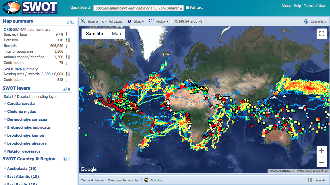
To see SWOT’s printed maps of sea turtle biogeography, go here.
USING SWOT DATA & MAPS
The sea turtle nesting and telemetry data contained in the SWOT database have been made publicly available by members of the SWOT Team for informational purposes and to help support and advance sea turtle research and conservation worldwide. You can request data from the SWOT database for your use in research, in educational materials, and for other purposes, subject to the SWOT database Terms of Use.
Learn more about using SWOT data →
Contributing Data to SWOT
The SWOT database is built on the voluntary contributions of data by hundreds of sea turtle researchers worldwide. We believe that sharing data about sea turtles in a publicly-available global database is critical to effective sea turtle conservation. SWOT welcomes contributions of published and unpublished nesting and satellite telemetry data, and manages data to protect the rights of the original providers. Join us and contribute data today!